
Look at this frilly little flower ... with the insect on it! Looks like it's wearing a tu-tu, eh?
...
My town, Port Washington, is about 17 miles east of New York City. It's very easy to take the Long Island Railroad straight in ... it's also easy to drive in, if you're not driving during rush hour ... which is all day!
There are about 33,000 of us living in this pretty place.
The land was first settled by the Matinecock Indians who sold the land in 1643 to 18 English families from Stamford, Connecticut. They named the land "Cow Neck" for the common pasture they used.
We're on a peninsula, so ... we have water on 3 sides!
The Mill Pond empties into the bay.

The Town of North Hempstead started this project many years ago.
The pond used to be a boring rectangle.

This is just off Shore Road. The other side is Manhasset Bay.

The town has given us a lovely brick walkway and many benches.
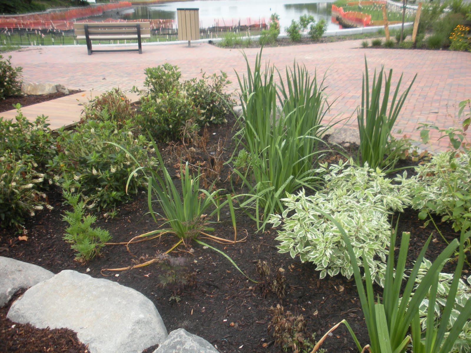
They've also been busy planting lovely gardens.
I took a minute to sit and just look out over the pond ...

I'm assuming all the stakes and lines and orange mesh will be coming down eventually. It will be very pretty! A huge improvement!

It's the site of the Mill Pond MYC (Model Yacht Club) The "Model Yachters" are a serious bunch.

Here's their fancy club house.
I wonder if they do weddings?
...
So I read about 30 pages of Sacred Hearts last night. I'm determined to get this one finished. I have no excuse because I'm on vacation! (can't blame it on too much work!)
...
As you can see ... I did NOT forget to start the GPS today. Tomorrow will be my big walk. I'm anxious to see how many miles I really do!

I was pleased to see that my lap pace was less than a 20 minute mile. (this picture was taken at 2.39 miles ... yes ... I did finish 5.1 miles!)
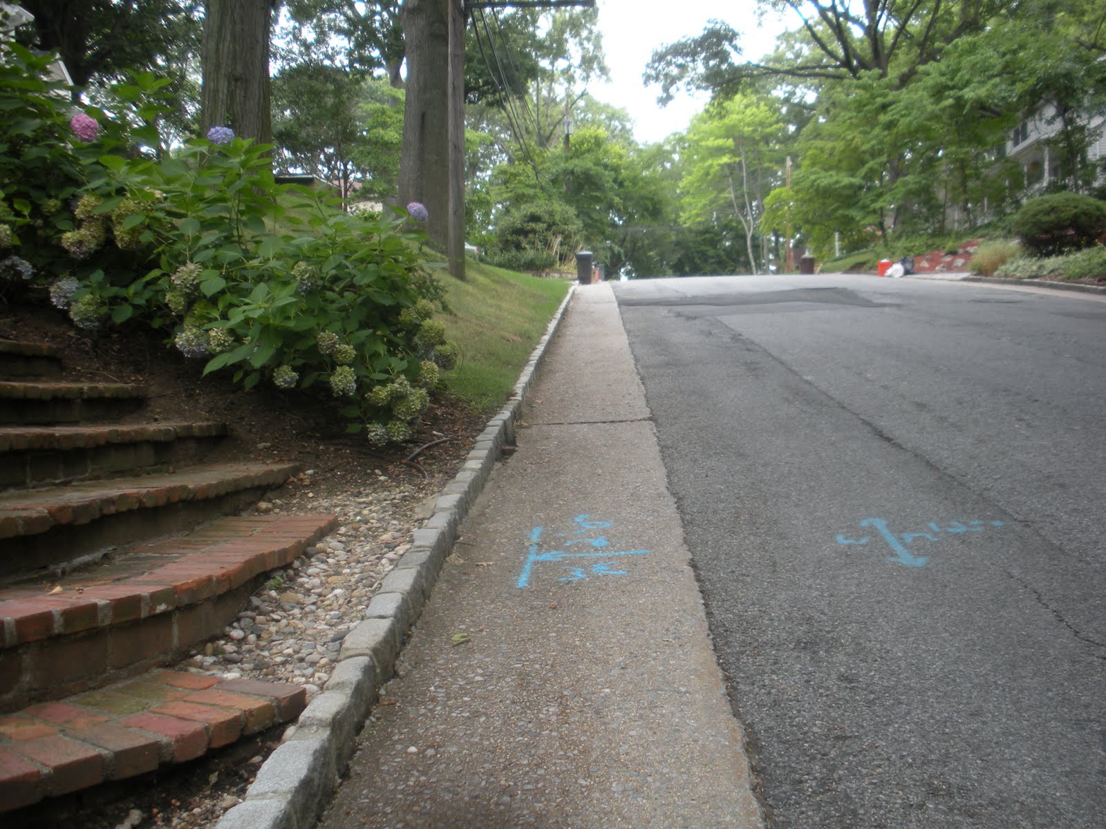
Finally ... this is the little hill just before I hit my street at the end of this route. I know you folks from the Hills of Georgia laugh at this ... and you folks who walk those Streets of San Francisco ask "what hill?" but it's a fairly steep incline. Isn't there a setting for measuring the incline on the Garmin?
Just wondering.
You can measure the incline on a iPhone.
ReplyDeleteOoops, you have a Blackberry. Too bad.
you need an altimeter, measure from sea level at bottom of hill, from sea level at top of hill then it is a right triangle, easy for a teacher, right.........
ReplyDeleteOY!
ReplyDeleteUpload to garmin.connect.com -- you can see elevation changes.
ReplyDeletesorry to be late tonight, i was reading! anyway the area looks lovely! and i remember once (when i could walk good) in podunk i left the house for a walk, turned right and headed up the road at a brisk pace. about fifty feet later i couldn't breathe at all, it was so steep and i didn't consider that or the altitude. didn't take me long to go home!
ReplyDeletesmiles, bee
xoxoxoxoxoxo